
「一人の学者ではカバーしきれない多分野の専門知識を動員することで初めて獲得できる研究成果がある」という考えのもと、デジタル日本史研究室はイェール大学マクミラン国際研究所東アジア学科の一部として発足しました。
主に近世日本史を研究対象とし、最先端の情報技術を応用した、デジタル人文科学のプロジェクトに取り組んでいます。現在、ファビアン・ドリクスラ教授のほか4名が専属研究者として所属しています。
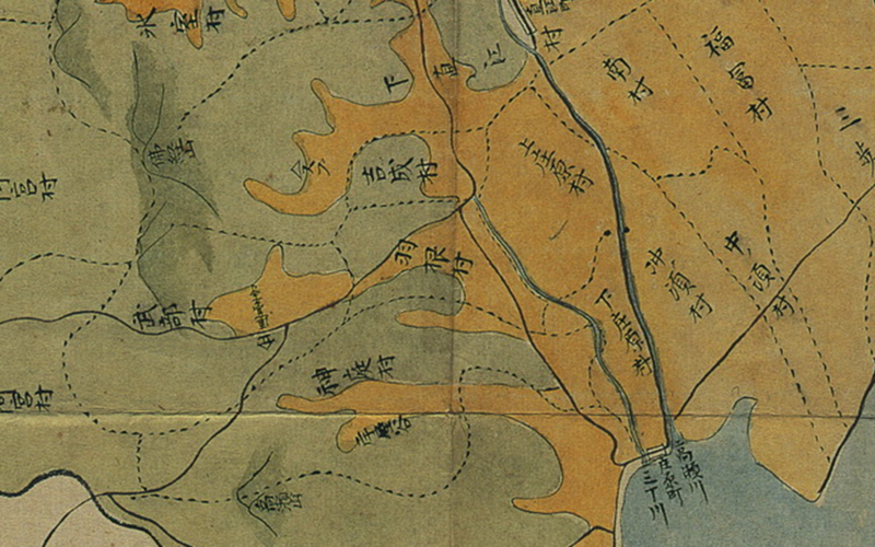
Village boundaries on Izumo-no-kuni jūgun bunzu Izumo-gun 雲国十郡分図 出雲郡 (1821)
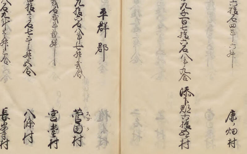
Genroku gōchou 元禄郷帳 (ca. 1700-1702), a list of villages and their assessed productivity by district
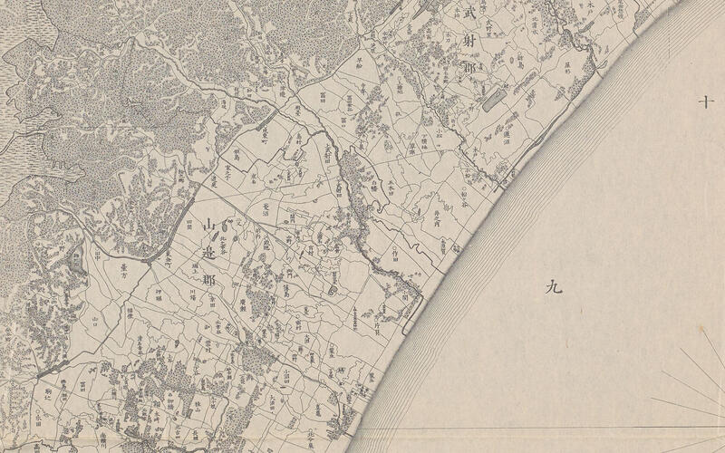
Village boundaries on Chiba-ken kannai zenzu 千葉県管内全図 (1883)
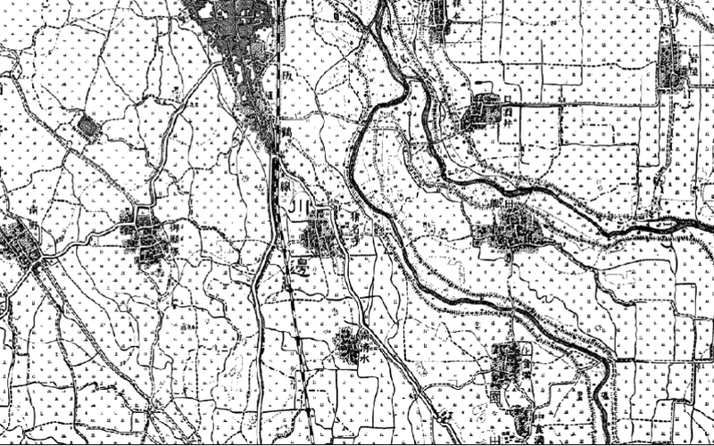
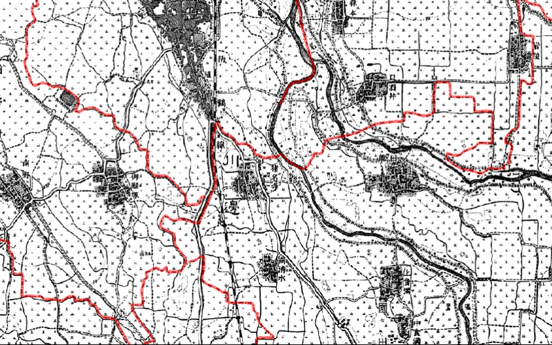
Village boundaries on a topographical survey map
A neural net recognizes village boundaries on a topographical survey map.
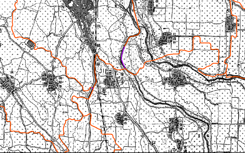
Manual review corrects and completes the neural net output
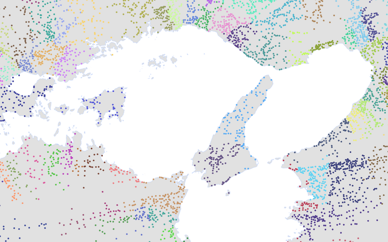
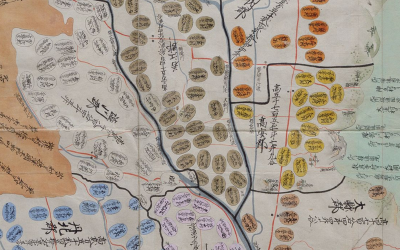
Village centers color-coded by district, 1868
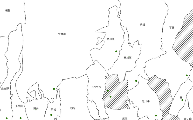
Village boundaries with village centers in green. Completed polygons in white, shaded areas require further work
Village locations on Genroku kuni-ezu 元禄国絵図 for Kawachi 河内国 (copy of a ca. 1702 map)
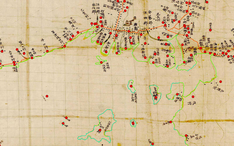
Inō Tadataka's map (1800-1816) overlayed with modern shapefiles for village locations, coastlines, and roads created by Murayama Yūji and his team (Dejitaru Inō-zu デジタル伊能図, 2015)